Twitter / X length
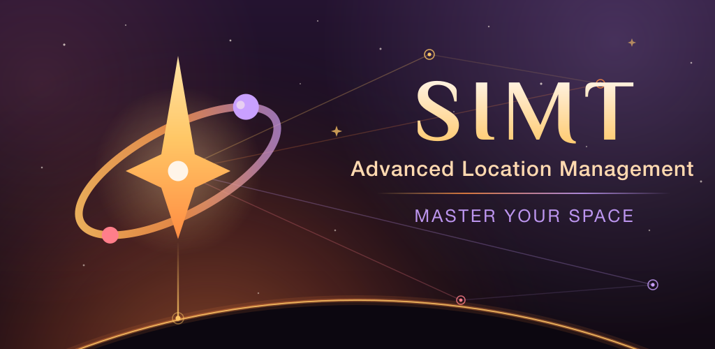
SIMT is a free, offline-first spatial toolkit for Android & Wear OS: precision compass, underground tracking, local-network sharing, AR measurement, and a pocket planetarium — all on-device.
Press & Media Kit · Updated June 2026
SIMT is an offline-first spatial toolkit for Android and Wear OS. One free app lets you plan targets, recover your car deep underground without GPS, share live position over local Wi-Fi when the network is gone, measure with AR, and fly through the solar system — all computed on the device, with nothing leaving it unless you ask.
Reviewers: request a promo code or a walkthrough at [email protected].
Copy-ready descriptions at three lengths.
SIMT is a free, offline-first spatial toolkit for Android & Wear OS: precision compass, underground tracking, local-network sharing, AR measurement, and a pocket planetarium — all on-device.
SIMT replaces a stack of single-purpose apps — compass, offline navigator, underground tracker, local-sharing radar, AR tape measure, and sky map — with one privacy-first Android and Wear OS app that keeps working where the signal, the network, and the cloud give up.
SIMT is an offline-first spatial toolkit for Android and Wear OS. Where ordinary map apps stop — underground, offshore, in a packed stadium, or far from any tower — SIMT keeps you oriented by fusing raw satellite data, camera motion, and device sensors entirely on the phone. It plans targets, recovers your position without GPS, shares location device-to-device over local Wi-Fi, measures spaces in AR, and tracks planets and satellites offline. It is free, ad-free, and built so your data stays on your device by default.
The essentials, at a glance.
app.simtEach of these is a standalone article waiting to happen — pick the one that fits your beat.
SIMT reads the raw satellite measurements most apps never touch and runs its own positioning engine. Feed it free internet corrections and it reaches centimeter-class RTK accuracy — the kind of result that used to need thousands of dollars of equipment. Apple’s iOS doesn’t expose this data at all, so this only exists on Android.
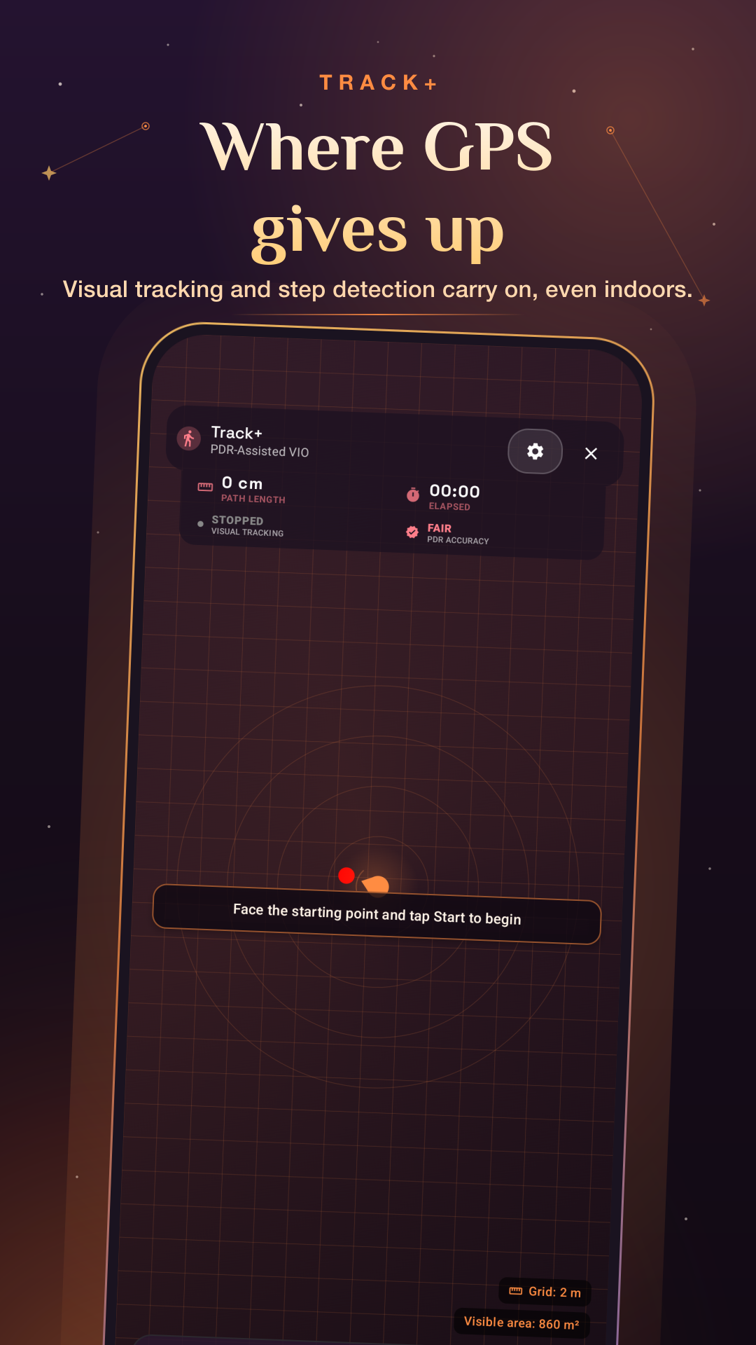
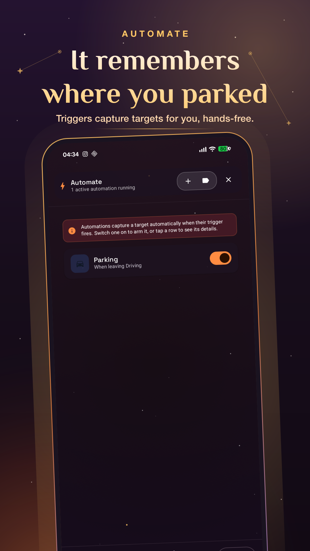
Park five floors underground and the blue dot is useless. SIMT’s Track+ fuses step dead-reckoning, camera motion, the barometer, and the building’s own magnetic quirks to keep a live breadcrumb trail — so you can simply walk back to your car. No signal, no map of the garage, no problem.
Iris paints a target onto your live camera using only the orientation sensors and the lens’s own geometry — no ARCore, no depth camera. So it runs on budget phones mainstream AR leaves behind, works fully offline, and can even point you at a satellite or planet that’s above the horizon but out of sight.
Eighty thousand phones in one stadium and the towers buckle — right when you need them. Link+ shares live position device-to-device over local Wi-Fi or Wi-Fi Direct, bootstrapped by an NFC tap. No tower, no roaming, no cloud. Built for exactly the conditions that break everything else.
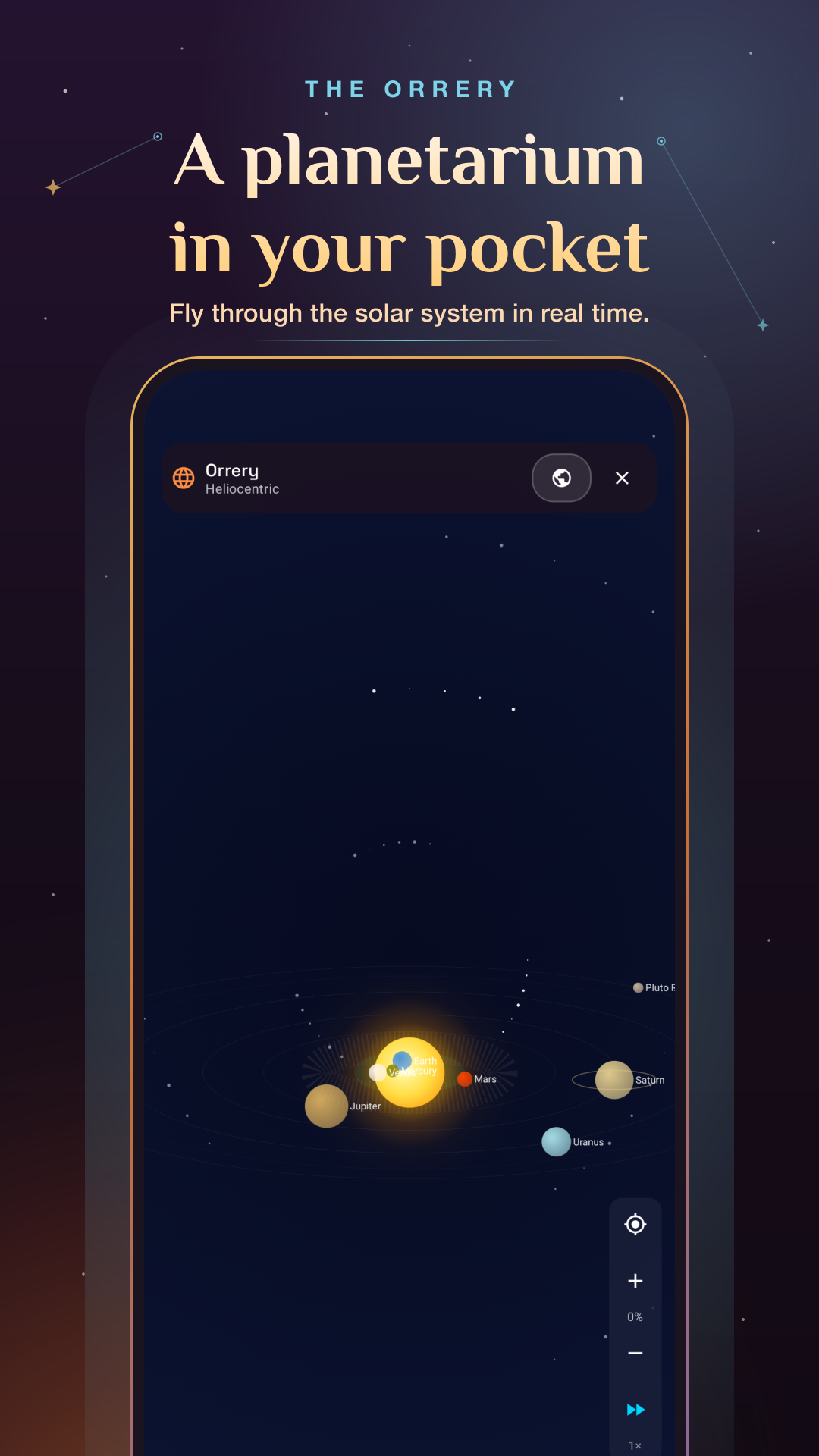
The Orrery flies the planets ±100 years at up to 500,000× real time, catches eclipses and conjunctions, and tracks the ISS and other satellites from orbital data. Want to know what the sky looked like the night you were born? It’s all computed on the device, no internet required.
“Azimuth,” “zenith,” and “nadir” all descend from the Arabic samt — “direction.” SIMT is named for it: a modern astrolabe that, like the original, needs nothing but the sky. A rare consumer app whose origin story runs through the House of Wisdom and the history of how humanity learned to ask which way?
SIMT started as a compass. It now works like an offline spatial toolkit — these are the headline tools.
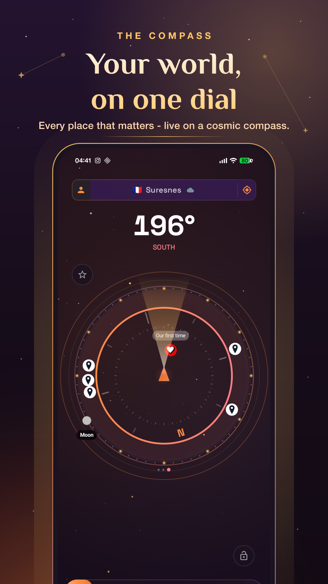
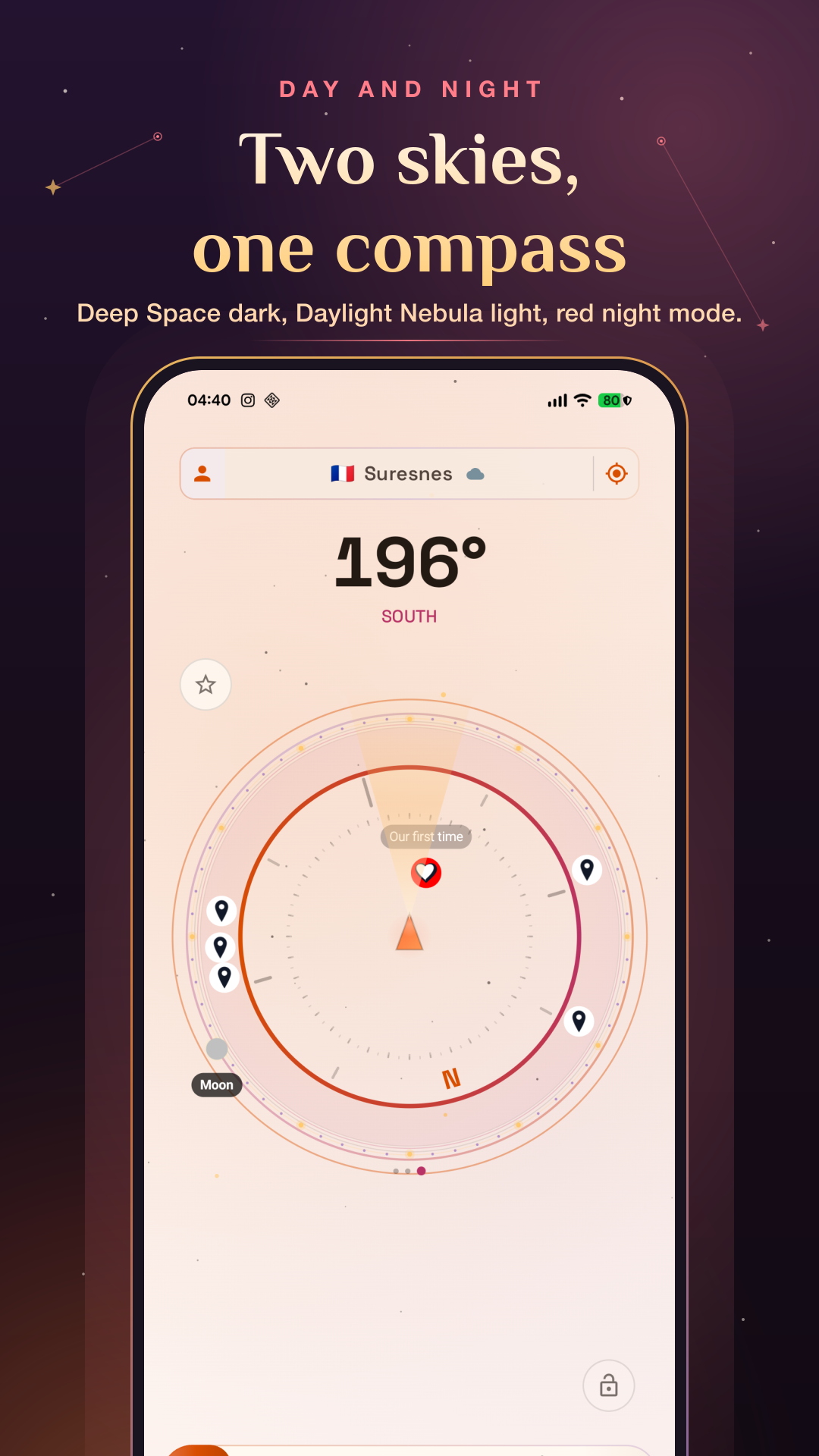
A precision dial showing true and magnetic north, with every target you care about as a live ring around you. Sun- and Moon-based calibration keeps the heading honest.
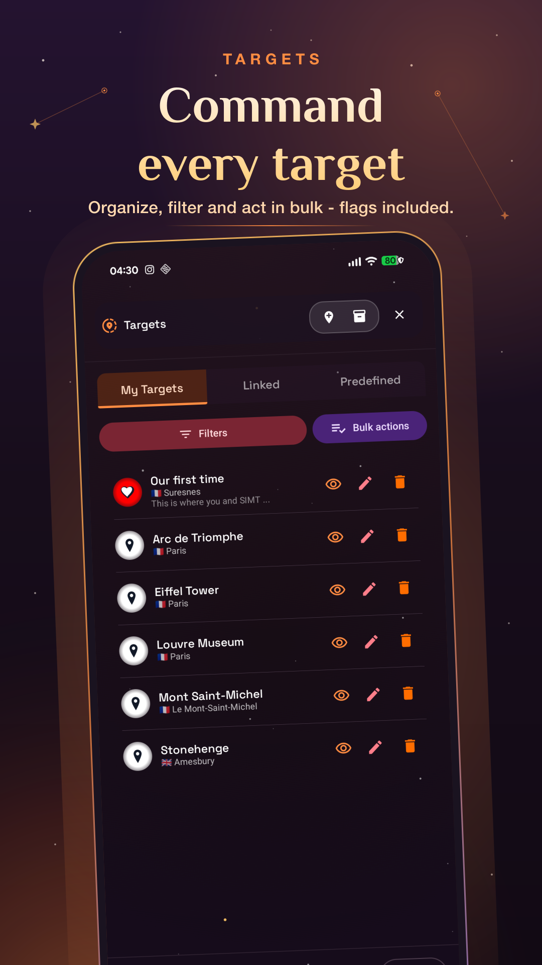
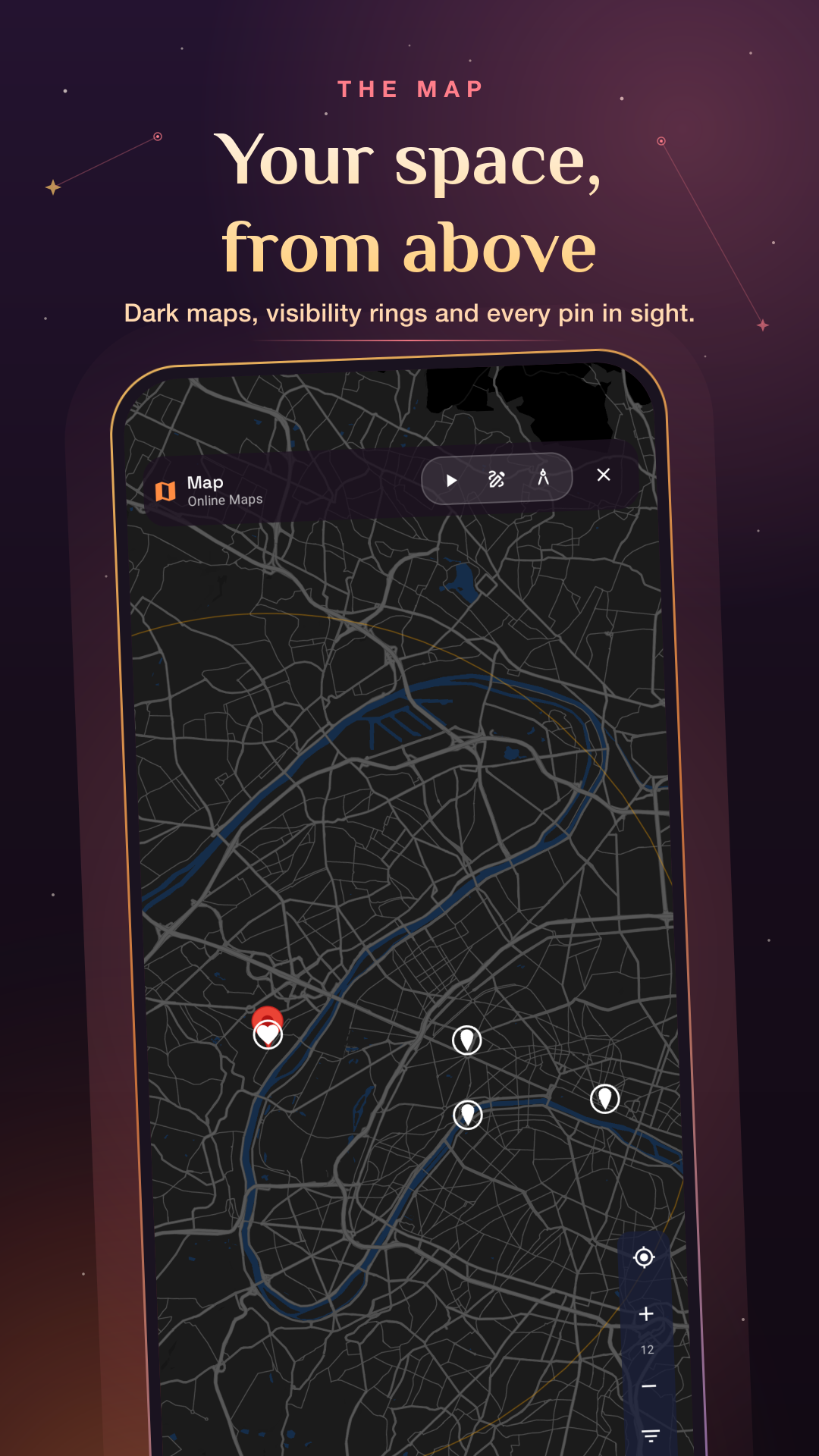
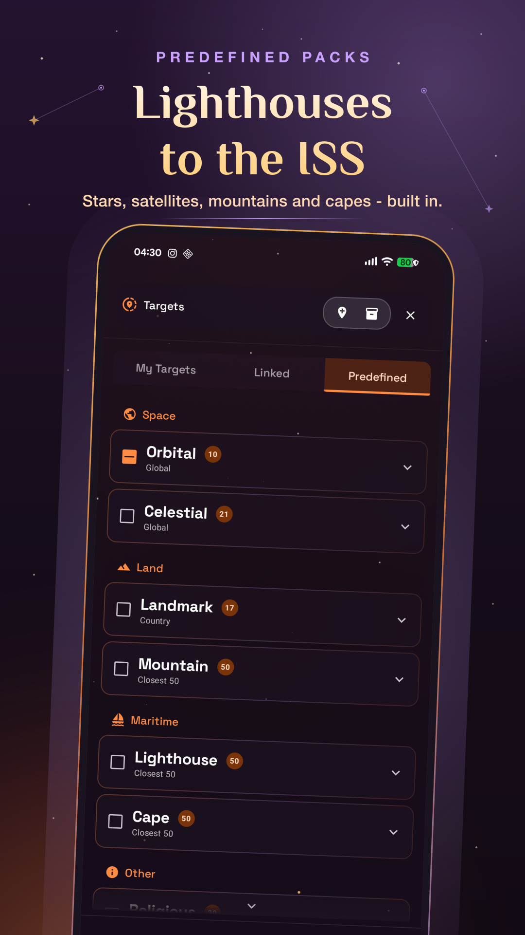
Save anywhere from a map, coordinates, a photo, a QR code, or notes — plus 1,100+ built-in landmarks. Tag, group, and navigate with online or fully offline maps.
A local positioning system that fuses pedestrian dead-reckoning, visual-inertial motion, the barometer, and magnetic/Wi-Fi fingerprints to keep your position alive underground and indoors.
Live, device-to-device location sharing over local Wi-Fi or Wi-Fi Direct, started with an NFC tap and secured with mutual TLS. Stays up when cell networks don’t.
AR distance and area measurement, a calibrated on-screen ruler for quick sizing, and a digital plumb bob for leveling, pitch, and roll.
Augmented-reality target overlay on the live camera using pure sensor-and-lens math — light on battery, works offline, and reaches phones mainstream AR can’t.
Planets, Moon phases, eclipses, deep-sky targets, and satellites tracked from orbital data — plus a live, time-traveling Orrery and Qibla direction. All on-device.
Multi-constellation raw-measurement processing (GPS, GLONASS, Galileo, BeiDou, QZSS, NavIC, SBAS) with atmospheric corrections and optional NTRIP RTK/PPP for survey-grade fixes.
Navigate from your wrist with synced targets, and let automations capture targets on a schedule, interval, altitude change, or activity — like auto-saving where you parked.
Plus seven one-tap experience roles — Explorer, Hiker, Traveler, Photographer, Astronomer, Builder, and Gamer — and a built-in location guessing game, GeoQuest.
A few figures that capture what SIMT actually does.
Adoption figures as of June 2026; for the latest, email [email protected].
Why SIMT keeps working where other apps stop — written for a general audience, accurate for an engineer.
Android is the only major mobile platform that hands apps the raw signals from GPS and other constellations. SIMT builds its own receiver on top of them — applying corrections for the ionosphere and troposphere, combining dual-frequency signals to cancel most of the error, and, with free NTRIP correction streams, resolving positions to the centimeter via RTK.
When satellites fade, Track+ blends step-counting, camera-based motion, the barometer, and the magnetic “fingerprint” of a building into one estimate of where you are. The same steel and wiring that confuse a naïve compass become landmarks SIMT uses to correct its own drift.
Planet positions, satellite orbits, Moon phases, eclipses, and magnetic declination are all computed locally with established astronomical and geomagnetic models. No astronomy server, no round-trip — the sky tools work in airplane mode.
Offline-first is a design decision, not a per-feature toggle. Maps fall back to an offline engine, geocoding works without a connection, and devices link directly to each other. Your targets, photos, and settings stay on your device by default; cloud backup is opt-in.
Under the hood: 100% Kotlin and Jetpack Compose · a modular, multi-engine architecture spanning WMM (magnetics), raw GNSS, VIO + PDR sensor fusion, an Unscented Kalman Filter, and VSOP87/SGP4 orbital models · CameraX and ARCore where available, with graceful fallbacks where it isn’t.
For more than a thousand years, when people needed a word for which way?, they reached for the Arabic samt. It traveled through the House of Wisdom and the astrolabe into the languages of science, surfacing in English as three words we still use to map the sky: azimuth, zenith, and nadir.
SIMT is named for that word. It began as a precision compass and grew, feature by feature, into an offline-first toolkit for the same enduring question — where am I, where is the thing I care about, and how do I move accurately from here? The throughline is a refusal to depend on a perfect signal or a constant connection. Underground, offshore, in a packed venue, or under a dark sky, SIMT is built to keep answering.
It is the work of one person: Said Elimam, a Paris-based engineer, filmmaker, and music composer. That mix is deliberate — SIMT pairs serious, offline-first engineering with an interface meant to feel calm, considered, and genuinely useful in the field. It is free and ad-free by choice.
Attributable to Said Elimam, creator of SIMT. More on request.
“Most apps assume the network will always be there. SIMT assumes it won’t — and works anyway.”
Said Elimam, creator of SIMT
“A direction is not a thing — you cannot put the zenith in a box — and yet our whole civilisation of maps, ships, satellites, and smartphones rests on our ability to name and measure it.”
Said Elimam, creator of SIMT
“The winning move underground isn’t a perfect live location. It’s keeping enough context to recover the route you already made.”
Said Elimam, creator of SIMT
Click any image to open the full-resolution file. Or grab everything at once.
Ready to paste at the end of an article.
SIMT is a free, offline-first spatial toolkit for Android and Wear OS that combines a precision compass, target planning, GPS-denied tracking, local-network location sharing, AR measurement, and offline astronomy in a single privacy-first app. Designed to stay useful where ordinary map apps stop — underground, offshore, in crowded venues, and under open sky — SIMT computes on the device and keeps your data on it by default. Learn more at simt.app.
SIMT is designed and built by Said Elimam, an independent Paris-based engineer, filmmaker, and music composer. That blend of disciplines is why SIMT pairs precise, offline-first engineering with an interface built to feel calm, considered, and genuinely useful in the field.
For interviews, review access, promo codes, additional screenshots, or anything you can’t find here, get in touch — happy to help on deadline.
[email protected]