Deep Parking Recovery
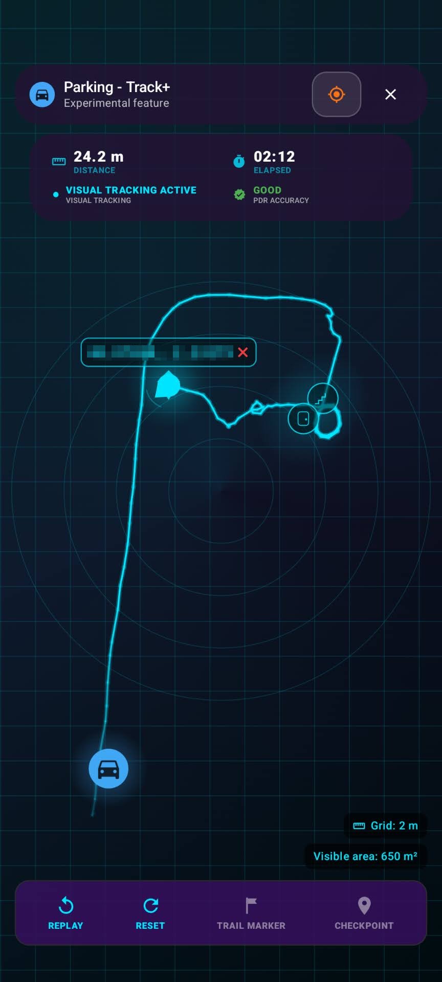
Track+ helps you recover your route through multi-level garages and other weak-signal spaces where GPS fades. Use step tracking, visual motion, and checkpoints to return to your vehicle with practical, on-device guidance.

Offline-first spatial toolkit for Android and Wear OS
Plan. Track. Measure.
One offline-first app for Android and Wear OS that keeps working where map apps quit. Plan targets, find your car underground, share your live position over local Wi-Fi, measure with AR, and track planets and satellites, all computed on your device.
Available now on Android 9+ with Wear OS companion support.
From underground garages to open water and dark-sky nights, SIMT stays useful where ordinary map apps stop.
Track+ helps you recover your route through multi-level garages and other weak-signal spaces where GPS fades. Use step tracking, visual motion, and checkpoints to return to your vehicle with practical, on-device guidance.
When you are offshore or outside normal coverage, SIMT can still orient you with offline directions to capes, lighthouses, and the nearest land points. It works as a reliable backup when ordinary map apps depend too heavily on connectivity.
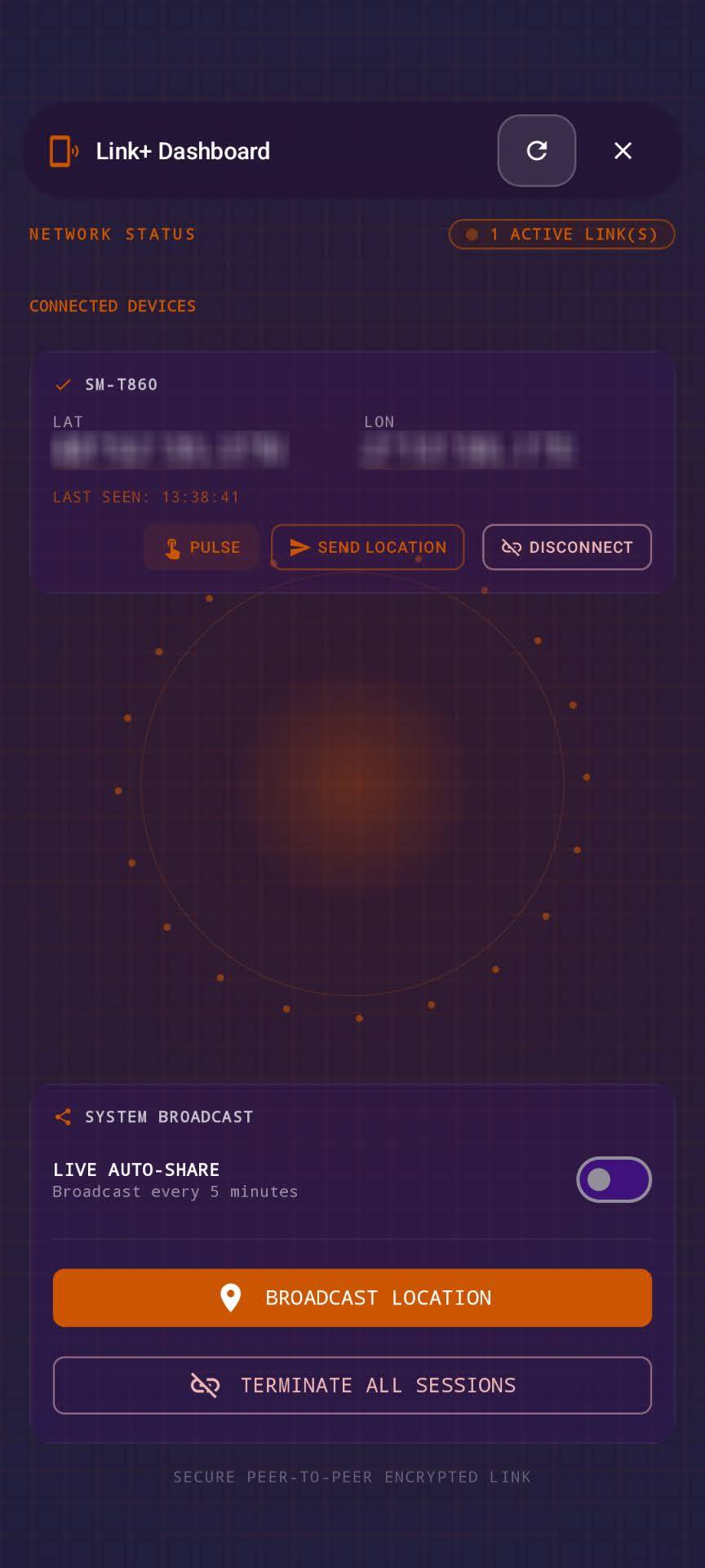
Link+ helps small groups stay aware of each other across festivals, stadiums, campuses, and other crowded venues. Share live position over the same local network without relying on mobile data.
Use AR measurement for quick distance and area checks, then switch to calibrated on-screen tools and leveling modes when you need a second reference. It fits light site work, furniture planning, and everyday layout decisions.
Follow planets, Moon phases, satellites, and celestial targets from the same app you use on the ground. SIMT calculates positions on device, so the astronomy tools remain useful even when you are offline.
SIMT supports orientation and Qibla workflows with precise bearings, haptic feedback, and TalkBack-friendly screen reader behavior. The goal is clearer, more independent guidance without extra setup.
SIMT is not only for solo navigation. It can link nearby phones, sync targets to Wear OS, and keep your data portable without turning into a cloud-first product.
Start with an NFC tap and share your live position with people on the same Wi-Fi or LAN, encrypted, even when there is no internet connection.
Sync targets to your watch and keep navigating from your wrist when you do not want to hold the phone.
Keep data local by default, then back up targets, images, and settings to Google Drive only when you want to.
If Google Maps or online geocoding are unavailable, SIMT falls back to its own offline engines instead of leaving you stuck.
Target planning, GPS-denied tracking, AR tools, advanced GNSS, and spatial overlays live together in one Android experience instead of being spread across multiple apps.
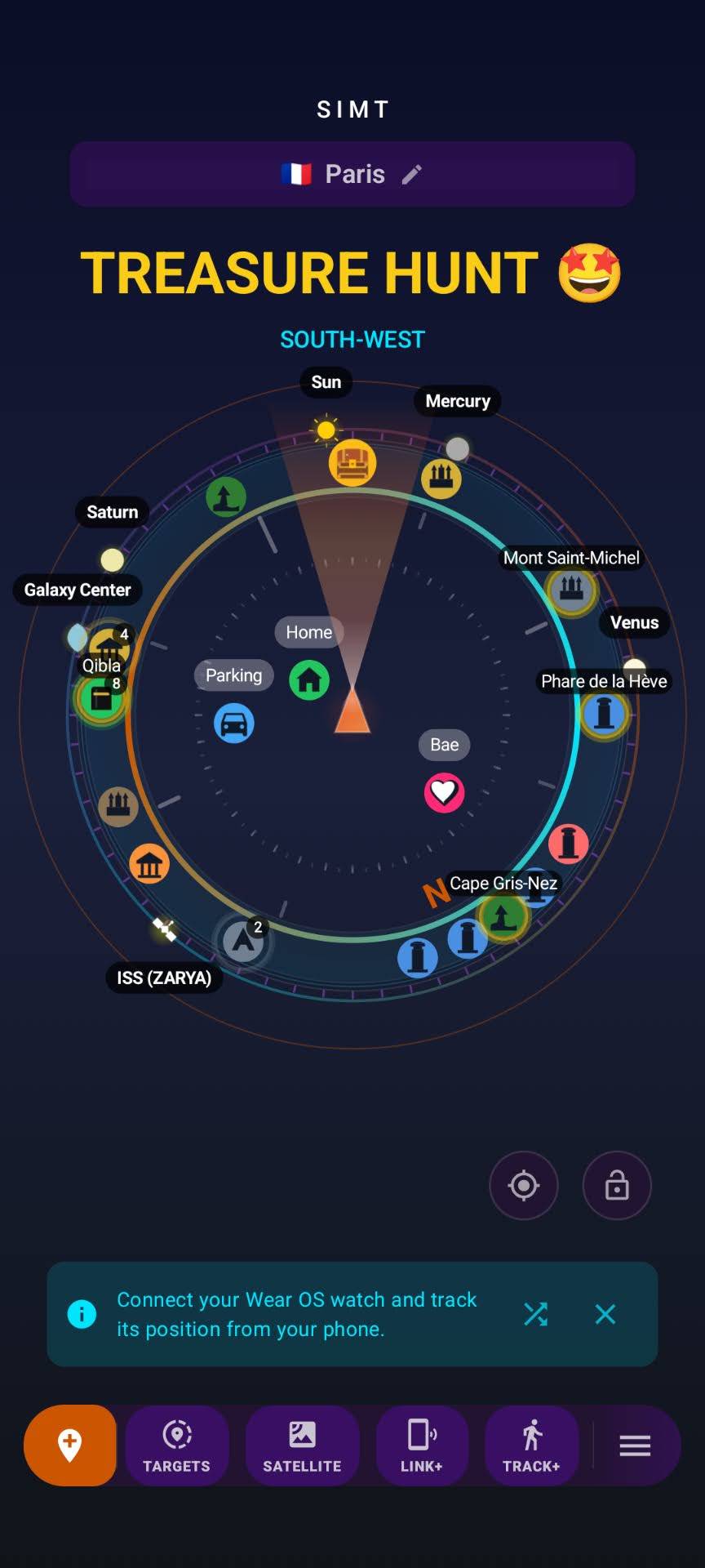
SIMT is a complete offline-first spatial toolkit for planning, tracking, measuring, sharing, automating, and exploring the sky, all in a single app.
Create targets from maps, coordinates, photos, QR codes, and notes, or start from 30K+ built-in cities, with online and fully offline map support.
Track+ fuses camera motion, step detection, sensors, and checkpoints to recover position in underground parking and other weak-signal areas.
Use Ray+ for AR distance and area measurement, Measure for calibrated on-screen sizing, and Plumb Bob for leveling and pitch and roll work.
Track planets, Moon phases, satellites with TLE data, deep-sky targets, and the live Orrery without depending on cloud astronomy services.
Targets, images, and settings stay on your device first. Optional Google Drive backup and restore is there if you decide you want portability.
Every feature is unlocked for everyone, with no paywall and no forced ads. Support the app by choice, never because a tool is locked away.
Iris overlays your saved targets, satellites, and planets on the live camera with no ARCore required, so it runs offline and even on modest phones.
On supported hardware, SIMT reads raw multi-constellation GNSS and can apply optional NTRIP RTK corrections to push positioning toward centimeter precision.
Let SIMT capture targets for you. It can remember where you parked and log points on a schedule, interval, altitude change, or activity, hands-free.
Field Notes
Practical ideas, field-tested workflows, and clear explainers from the SIMT Blog, refreshed here whenever a new guide is published.
SIMT combines offline planning, GPS-denied tracking, survey-grade GNSS, AR measurement and overlays, local device linking, automation, and offline astronomy in one privacy-first Android app.
Free, no paywall, and available now on Android with Wear OS support.
Android 9+ phone app with Wear OS companion support.
SIMT is an offline-first spatial toolkit for Android and Wear OS. It combines target planning, indoor and weak-signal tracking, AR measurement, advanced GNSS, local sharing, automation, and astronomy in one app.
Yes. Target guidance, movement tracking, offline geocoding, offline map fallback, measurement tools, astronomy calculations, and many planning tools work without internet. Online maps, weather, and cloud backup are optional.
Yes. Track+ combines visual tracking, step detection, sensors, and checkpoints to help recover your position in places like underground parking or other weak-GPS environments.
Yes. Ray+ handles AR distance and area measurement on supported devices, while Measure and Plumb Bob cover on-screen measurements and leveling tasks.
Yes. Link+ shares live location over the same local network, and the Wear OS companion syncs targets and lets you navigate from your wrist.
Yes. SIMT can track planets, Moon phases, satellites with TLE data, celestial targets, and a live Orrery view, and it also includes Qibla direction features.
Yes. SIMT keeps targets, images, and settings on your device by default. Optional Google Drive backup is available when you choose to use it.
SIMT runs on Android 9.0 or later and includes Wear OS support. Some tools, such as AR measurement or high-precision GNSS, depend on your device hardware.
Accuracy depends on your hardware and surroundings. SIMT fuses satellite, motion, and magnetic data with the World Magnetic Model for dependable true-north bearings, and on supported phones it reads raw multi-constellation GNSS and can use optional NTRIP RTK corrections to approach centimeter, survey-grade positioning.
Yes. SIMT is completely free with no paywall, and every feature is unlocked for everyone. There are no forced ads. If you want to support development you can optionally watch an ad or donate, but it is never required and never unlocks anything, because everything is already free.
Yes. SIMT includes haptic feedback and TalkBack-friendly screen reader support to make direction-finding more accessible.
SIMT comes from the Arabic word samt (سَمْت), meaning direction, the same root that gives English the words azimuth, zenith, and nadir. The name reflects the app's focus on knowing exactly where things are.